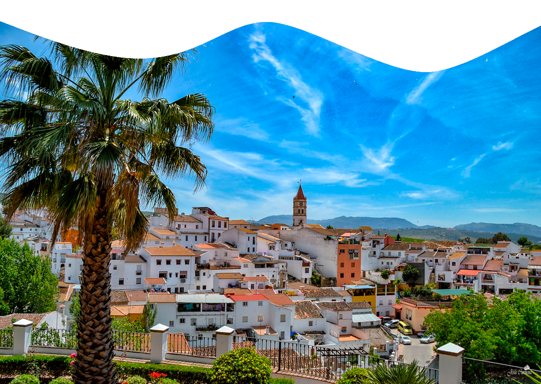
Our starting point is at the viewpoint of La Estacá, from where we can see wonderful views of the village of Arriate.
We continue along the asphalted road called Pista de Ronda which will take us to the Guadalcobacín River.
Once we reach this point the asphalted road disappears to give way to a track that will take us up to the farmhouse of “El Marqués”.
We take the left-hand lane which will lead us down a long straight road. At the end of this stretch we come to an area of stone pines, known as “Los Pinitos del Marqués”, a very well known and important area for the locals, as this is the place where a large part of the Romería of the municipality takes place and from where we can contemplate and enjoy some magnificent views, with the municipality of Arriate in the background.
We continue our journey along a gentle, long descent that takes us into a natural passage of holm oaks and Mediterranean scrubland on the outskirts of the path. At kilometre 4 we come across the Ermita de Los Frontones hermitage, now in a state of disrepair but which has been of great importance over the years, having been the place chosen for mass for many years during the aforementioned Arriate Pilgrimage.
We continue our descent until we reach the popularly known Huertas Abajo, where we come to an important fork in the road. This is a small roundabout at kilometre 5, where we must take the first exit. During this section we must be extremely careful because we enter a road that is busier than the previous roads.
After passing through a tunnel over which the railway line passes, we begin the ascent to El Cuco, where we will have to negotiate a steep slope that will take us to the outskirts of the village of
Ronda. This ascent is completely asphalted and although it is quite steep, it is quite easy to walk.
It is quite easy to walk up this climb.
Just at the top of the hill we take the lane on the left, nicknamed “Carril de la Muñeca” by the Arriateños.
by the Arriateños “Carril de la Muñeca” (so called because of a sculpture of a doll that exists inside one of the houses that we left at the edge of our route), in this lane there are sections of earth and concrete, which will lead us back to the Huertas Abajo.
towards Huertas Abajo.
After passing several forks, which are not to be missed if we follow the photographs below, we enter the so-called “Carril o Camino de la Sarna”, which runs practically parallel to the railway line until we reach the municipality of Arriate.
Arriate.
Once in the municipality of Arriate, we will follow the streets Gabriel Celaya, Avenida Andalucía and Arroyo de la China until we reach the Camino de Laura.
Then we will face the hardest climb of our route, as it is a lane with a steep slope and a perforated terrain that makes the transit through it quite difficult. At the start of this climb, we will have the opportunity to enjoy magnificent views of a large part of the Guadalcobacín Valley, as well as a magnificent panoramic view of the village of Arriate, with the Cerro de las Salinas and the Sierra de las Cumbres as a backdrop.
From the moment we reach the top of this path, the route becomes more bearable, as we will be walking through practically flat terrain of reddish earth.
At kilometre 15, at the “El Cortijo” campsite, we must take special care as we are forced to cross the A-367 road, which goes towards Ronda-Malaga.
A-367, which runs in the direction of Ronda-Málaga.
Our route will continue after crossing this road and taking the path at the back of the Los Pinos petrol station.
After approximately one kilometre, and after going down a steep slope, we arrive at the entrance to the “Bodega Los Aguilares”, which we leave to one side, to enter the Puente de la Ventilla along a winding path that takes us to the source of the stream of the same name and responsible for one of the most wonderful spots in the province of Malaga, the “Garganta del Arroyo de la Ventilla” (the gorge of the Ventilla stream).
To enter the gorge, we take the path on the right side of the stream bed, where we quickly enter a unique spot, surrounded by elms, willows, poplars, ash trees, walnut trees, ferns, etc….
As we walk along the narrow path, the gorge becomes narrower and narrower, and we can see the majestic cornices and gorges of Miocene molasse, carved by water hundreds of thousands of years ago.
At approximately kilometre 20, on one of these ledges in the gorge, you can see a bust of Félix Rodríguez de la Fuente, a small tribute to one of the first men in our country interested in the conservation and preservation of the environment.
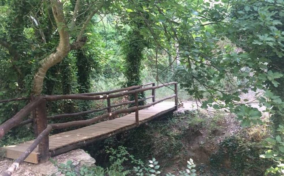
We continue our journey downstream, and a few metres further on we join the “Sendero local del Arroyo de la Ventilla”.
metres further on when we join the “Sendero local del Arroyo de la Ventilla”, which is fully signposted. When we reach this point, we follow the signpost and take the bridge on the right-hand side of the path.
We start the ascent towards the “Los Arroyos” estate, created a few years ago by the municipality’s Workshop School. Once we
Once we reach the top of this short but steep slope, we can enjoy a wonderful panoramic view of the gorge and it is even possible to see several caves that served as a refuge for many people in the past.
After reaching the top of the hill and leaving this farm behind, we take an asphalted track that will take us through the well-known “Huerta María Nieves”, where we will come out onto a winding path that will take us down again to the bed of the Arroyo de la Ventilla, where the “Molino Quemao” is located, nowadays known as the “Molino Verde” (Green Mill).
Once we have reached this point, our path will encourage us to follow the course of the stream downstream, continuing along the section of the new path called “Sendero Arriate – Molino Canto” (Arriate – Molino Canto Path). After following this route and crossing several bridges over the river bed, this path will take us to the entrance to the town centre in the area next to the Miramón Mill, this being the end of our route.
+34 952 16 50 96
Atención telefónica · De 8:00h. a 14:30h.
Dirección: Plaza de la Emigración Arriateña, s/n, 29350 Arriate, Málaga, Spain
Arriate 2022. Todos los derechos reservados © Nattule. Desarrollo web NattuAR
