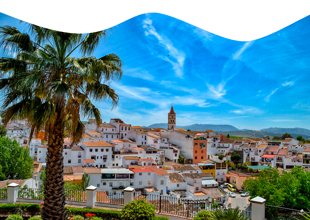
We start our route along the asphalted road next to this viewpoint, called “Pista de Ronda”, which takes us to the Guadalcobacín River. On one side of the road, the orchards run parallel to the river, and on the other side we find the typical cliffs of our gorges.
Once we reach the course of the river, after about 700 metres, the asphalted road disappears to give way to a dirt track that climbs up to the place popularly known as “Cortijo del Marqués”. During this stretch, we can see the herbaceous crops on both sides of the path.
At this point (Cortijo del Marqués) we come to the first fork in the route. We must take the path on the right and
after passing a gate we begin our ascent through a perforated terrain.
through a perforated terrain. On both sides of the path, there is an abundance of holm oaks, as well as rockroses, steppes, lavender, thyme, broom etc…
At the 2.8 km mark, there is a water reservoir which provides water for all the herbaceous crops in the area.
As we continue our ascent we can find farms dedicated to the exploitation of Iberian pigs, which feed on the acorns that grow in the wonderful holm oaks that can be seen in this territory.
We continue ascending until we reach the “Cortijo Madrid”, where the slope becomes
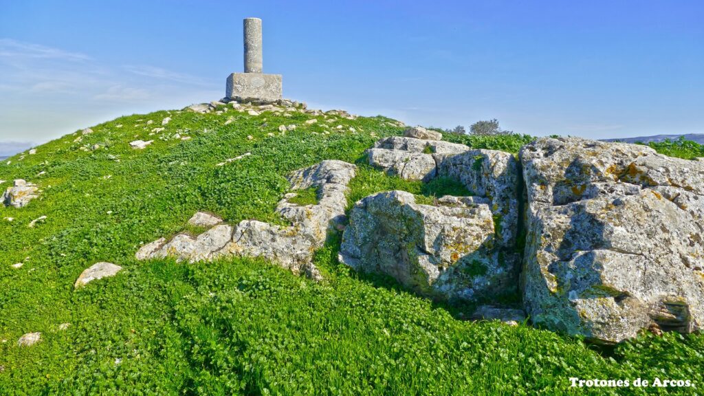
The slope becomes gentler and we can take a well-deserved rest next to a pillar which serves as a watering place for the farmhouse’s livestock.
About 100 metres further on we reach the second fork in the path, which will take us to the top of “Cerro de Las Salinas”. After leaving the public road and passing through two gates approximately 50 metres apart, we enter the estate and start to walk along the edge of the hill.
This area is of great geological interest, as there is a natural upwelling of raw salt from the very mantle of the earth, this effect being caused by the proximity of the Trías siliceous series to the earth’s crust. In the past, these salt pans were used
by the locals to salt many of their foodstuffs. In the same way, this spring is what gives its name to both the Cerro de las Salinas and the stream that rises from this hill and reaches the outskirts of Arriate.
About 200 metres past this point, we can take any of the paths that will take us to the Geodesic Vertex of the Cerro de Las Salinas, located at 954 metres, where we can enjoy impressive views.
For a mountain with a relatively low altitude, it is possible to observe a large number of villages, valleys and outlying mountain ranges, and it is even possible to see the Sierra Nevada on days with good visibility.
This route also has a history behind it, and with the passing of time its legend has grown bigger and bigger.
A bit of history…
The first historical references that refer directly to the “place of Arriate” date back to 1407, when the governor of Cañete la Real, Hernando Arias, surprised the Arabs of Ronda in an ambush in the banks of the river Guadalcobacín (next to the Cerro de Las Salinas). This historical event became known as the “Batalla o Celada de Arriate” (Battle of Arriate).
Legend has it that the Muslims who passed through the area carried large chests full of treasure, the result of the looting of the places they subdued after a battle, or as a ransom for freeing a prisoner. The point is that they were suddenly besieged by the troops of the warden of Cañete and, seeing that they were practically at the mercy of the enemy, who
practically at the mercy of the enemy, who also cut off their passage across the river
Guadalcobacín, and hindered in their movements by the load they were carrying, some of them decided to climb the Cerro de Las Salinas and look for a place to hide the treasure so that it would not fall into Christian hands. This is what they did, and moreover, before dying, many of them swore to defend to the death the booty they had hidden there.
Much later, in the midst of Napoleonic domination, some Frenchmen would hear in any tavern the story of what had happened 400 years before in the Cerro de las Salinas, and knowing of their fame as plunderers, they soon formed a small group willing to find the treasure and keep it without anyone knowing about it.
without anyone finding out. So they set off into the bush. Several days passed without any news of them, so their comrades in the battalion raised the alarm to their commanders, who took the necessary steps to locate the missing soldiers.
Four days later, they were located. They were all found dead, savagely murdered. The first thought was that they had fallen into the hands of a group of Spanish guerrillas, but the investigation yielded little more than that. Harassed by his superiors, the captain in charge of the investigation had no choice but to close the case, stating in his report that the soldiers had been killed in a skirmish by Spanish rebels. Although rumours that the soldiers’ wounds were inflicted by bladed weapons with broad, curved blades soon spread throughout the town, giving rise to many stories, each more terrifying than the last.
Behind every legend there is a reality, we leave it to each one to draw their own conclusions…
+34 952 16 50 96
Atención telefónica · De 8:00h. a 14:30h.
Dirección: Plaza de la Emigración Arriateña, s/n, 29350 Arriate, Málaga, Spain
Arriate 2022. Todos los derechos reservados © Nattule. Desarrollo web NattuAR
